Geoelectrical surveys can be applied to research the subsurface’s geological environment. During the surveys information can be gathered not only about the geological layers, but also about contamination which has different electrical conductivity than the surrounding environment. The higher the difference in the electrical conductivity, the more precisely the contaminated are can be determined. Geoelectrical surveys can be applied not only to determine the position of the contaminated area, but also to track changes over time, e.g. during remediation activities.
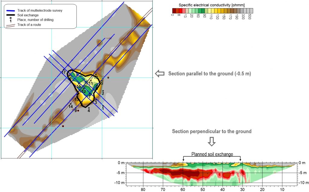
The hydrocarbon contamination can be for instance properly distinguished from its environment based on electrical conductivity. On the figure below an example can be seen where the aim was to determine the contaminated area, where remediation activities can happen (e.g. soil exchange).
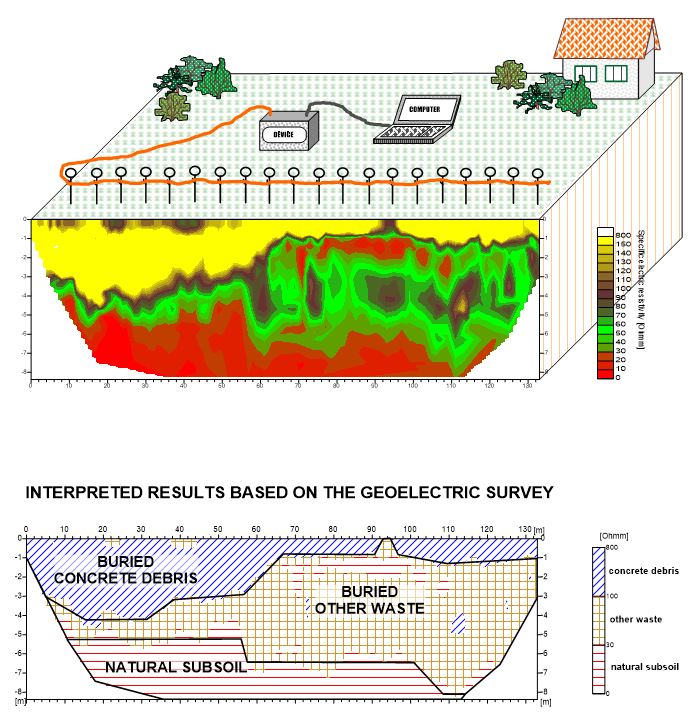
During the recultivation of existing landfills, the segregation of waste materials and natural soils might be needed as shown on the example below. The high resistivity concrete debris and the subsoil can be clearly traced with a variable depth along the line, further down the impermeable clay can be seen.
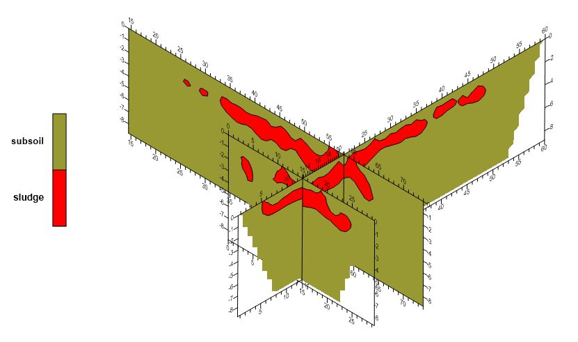
With geoelectrical surveys the buried waste can be detected or other buried objects (e.g. barrels) which can be later source of contamination. Another standard application is to detect the buried sludge after deep drilling, which can be seen on the below figure.