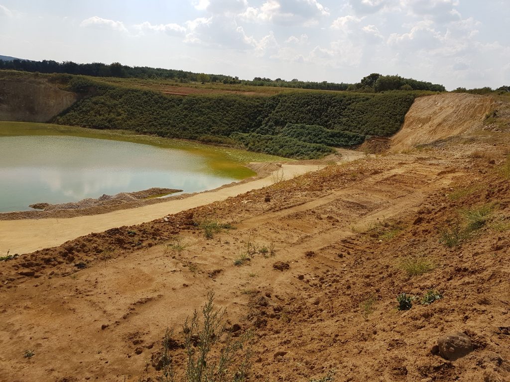
Research of mineral reserves
Geoelectrical surveys can be applied to outline the mining areas before exploitation, to determine the expansion area during exploitation, to assess available reserves and to support economic assessment during planning. Geoelectrical research is based on the fact, that different types of soil layers have different electrical properties. With the help of electrical resistance measures, the location and extension of exploitable gravel-sand-clay deposits can be estimated. The boundary of the granular layers can be discovered, the thickness of the cover and gravel layers can be estimated.
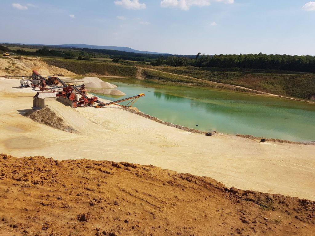
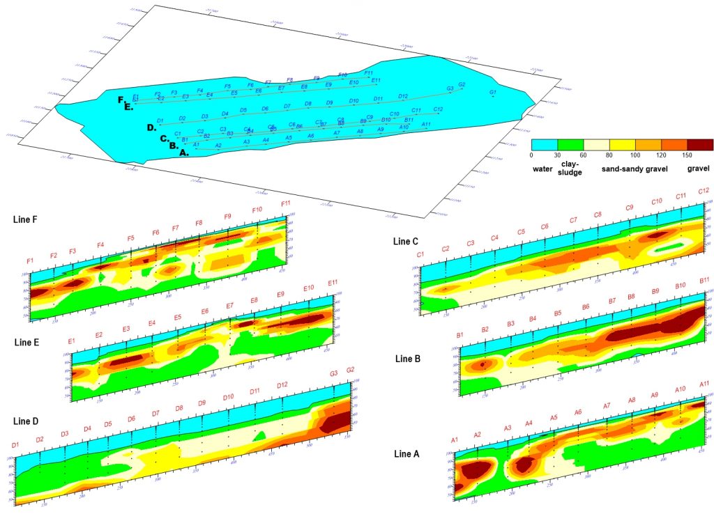
One of the standard applications is that in case of mines under exploitation it can be determined whether there are further reserves below the tailing pond. The gravel layers and spots can be defined within the potential expansion area, and the volume of the reserves can be detected. On the figure below the results from a geoelectrical survey on a tailing pond are shown. Based on the iso ohm lines, it can be stated that the pond contains minor gravel to mine, some gravels are rather along the shores.
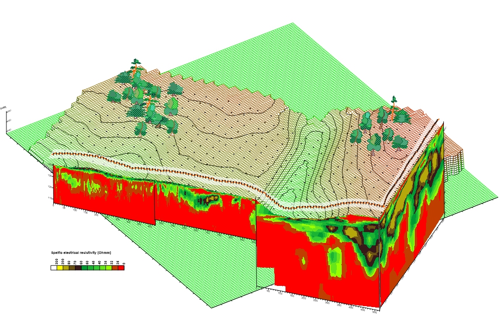
Research of soil structure
Geological layers should be defined for example during waste landfill’s pre-planning phase research. With geoelectrical survey the location of permeable and impermeable layers can be determined to a large extent, thus the use of artificial insulation can be minimized by optimal utilization of natural impermeable layers. The figure below shows the results of a survey performed for the planning of a municipal solid waste landfill. Impermeable layers are shown in red, the permeable layers in yellow. In the best-case scenario, the landfill should be planned over the area with low specific resistivity (indicated in red), as here the clay layers can be used as natural impermeable layers.