
The aim of the geoelectrical survey is to understand the geological structure, to determine the cover layer and changes in the soil structure, to observe the layers vertically and horizontally.
Drainage basins usually have complex geology, spreading over a large area, where residential areas, lakes, rivers and diverse topography make the surveys complicated. On the below example the survey results of a 30 km2 area can be seen. The geological structure can be nicely tracked despite the huge distances.
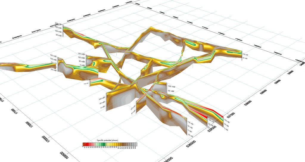
Red colour (ρ < 35 ohmm) indicates good impermeableness, it can be clay or marl. Green colour (35 ohmm < ρ < 65 ohmm) represents medium impermeableness, hard marl can be in this electrical potential range. The range of 65 ohmm < ρ < 90 ohmm, highlighted by yellow forms an interim between the marl and sandstone. The range highlighted by brown (100 ohmm < ρ < 200 ohmm) mainly marks sandstone from different eras, however, porous dolomite and limestone can be in this range as well. Grey colour (200 ohmm < ρ < 800 ohmm) represents mostly dolomite from Trias.